Live operations platform
Your entire operation,on one live map.
Wetapoint puts every person, task, and incident on a single real-time map — GPS-verified check-ins, push-to-talk radio, live video, and an audit trail that holds up afterwards. Built for festivals, field games, public works, and security teams.
EU-hostedGDPR self-serveFree for 10 usersCancel anytime
4
task types — location, area, path, action
31
webhook events for outbound integrations
Push-to-talk
radio with live video on iOS, Android & web
Append-only
audit log, with actor and timestamp
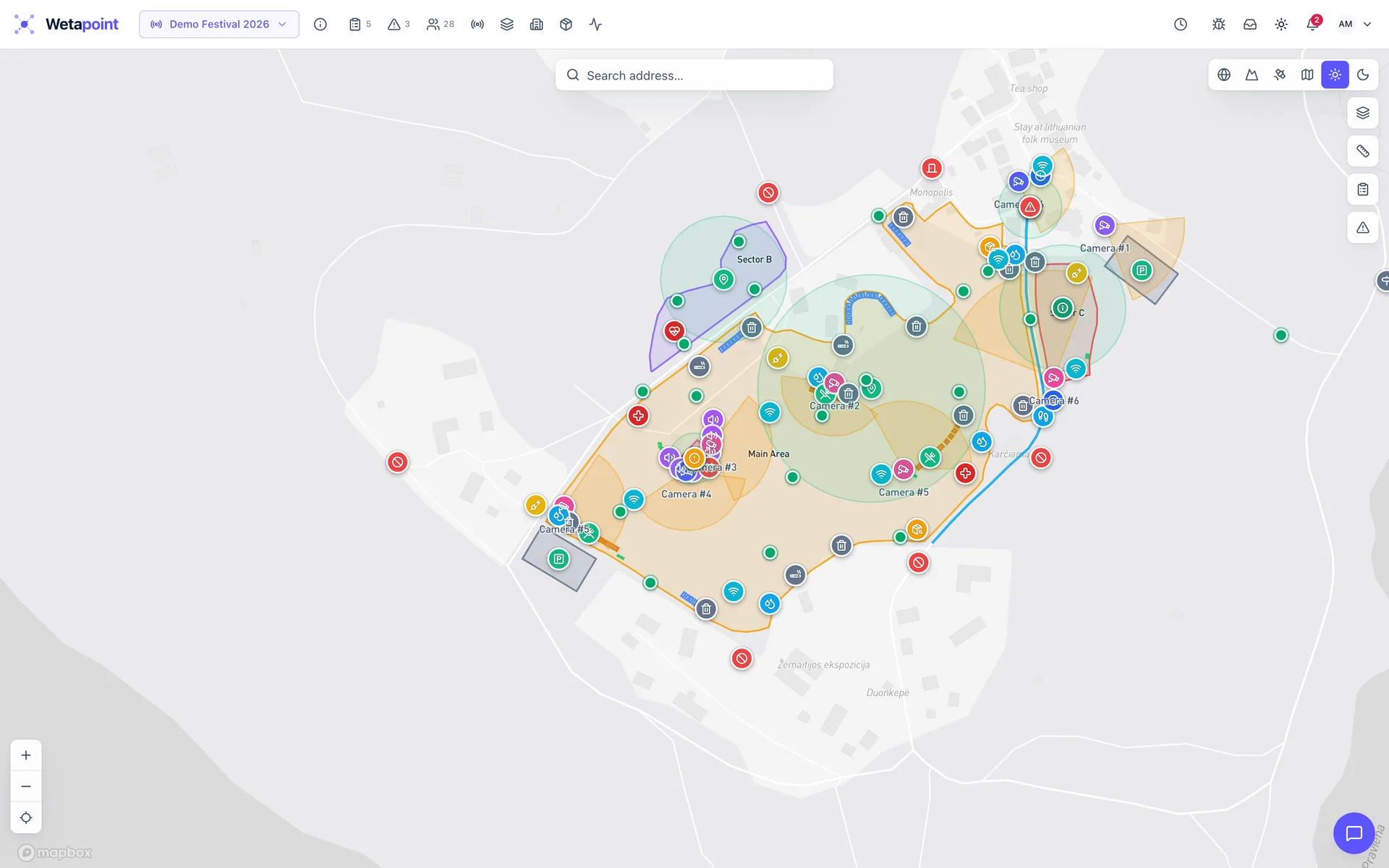
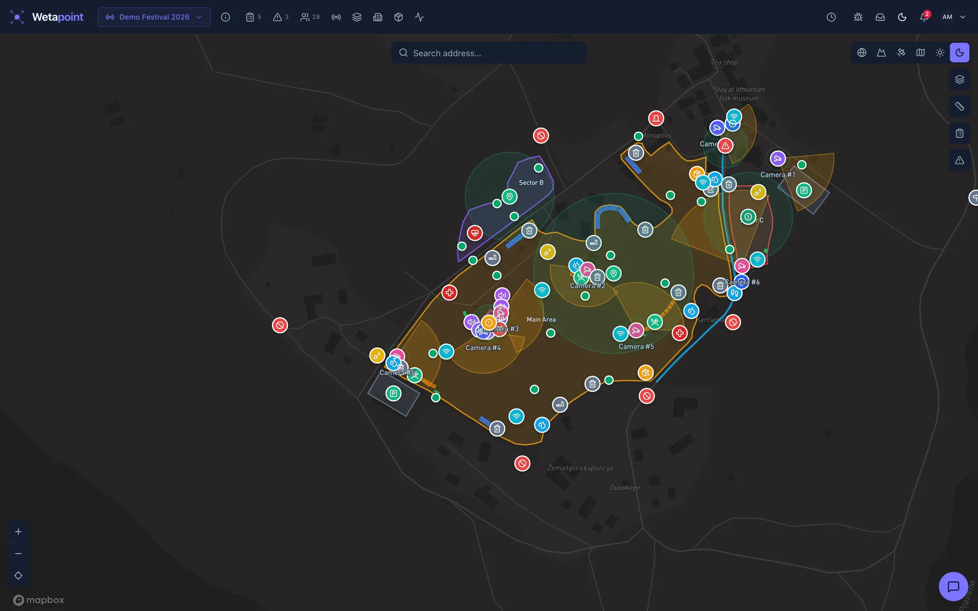
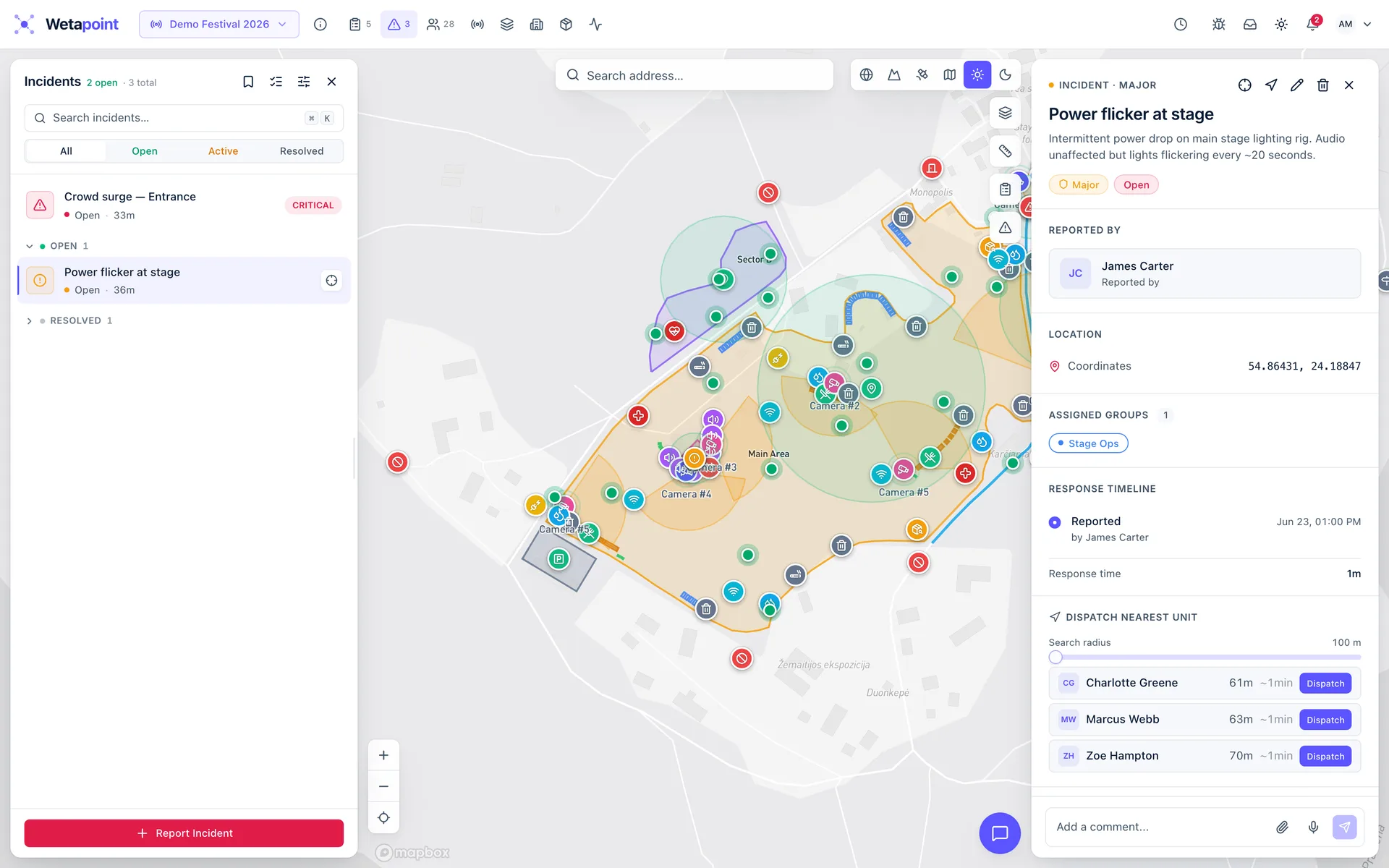
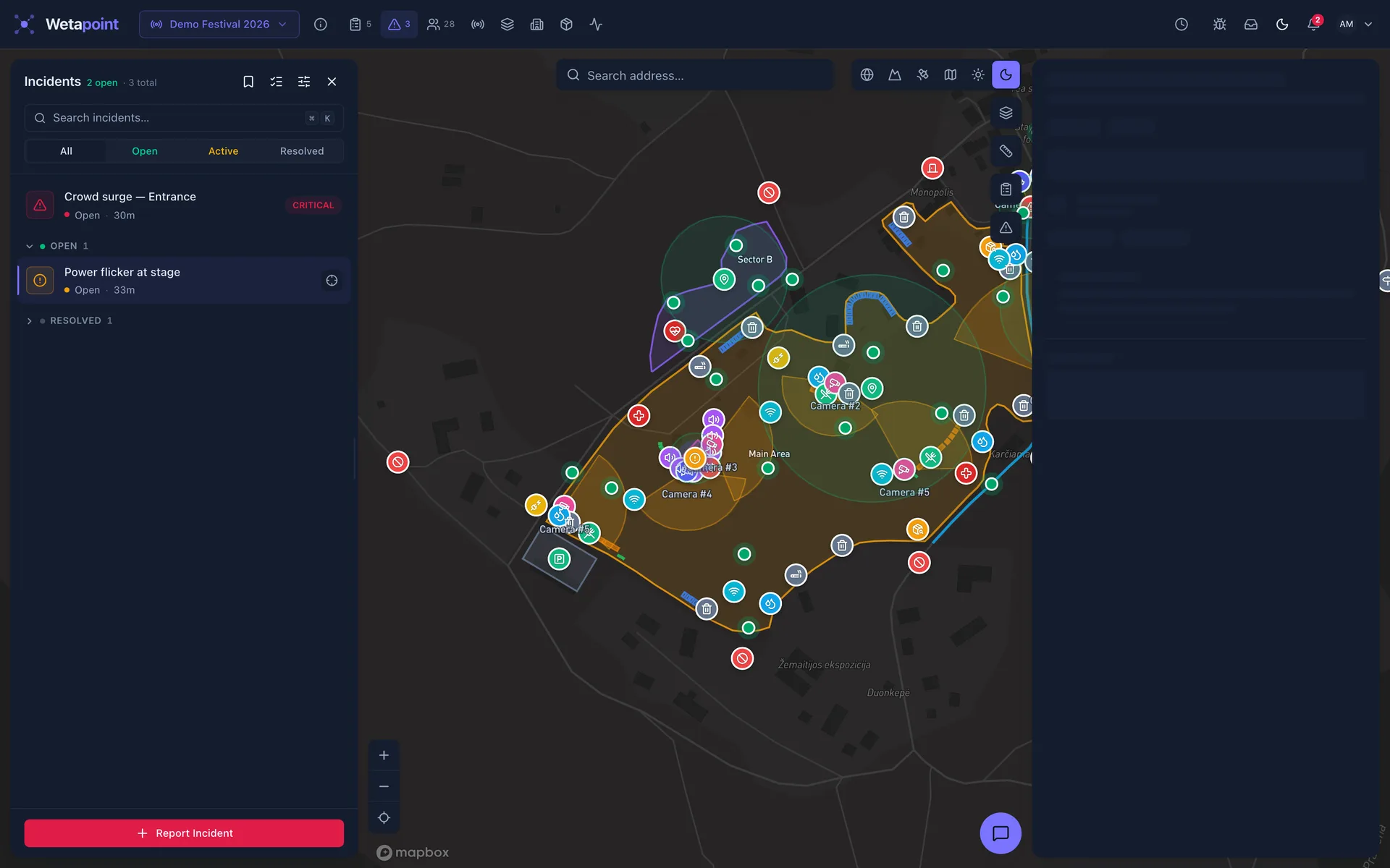
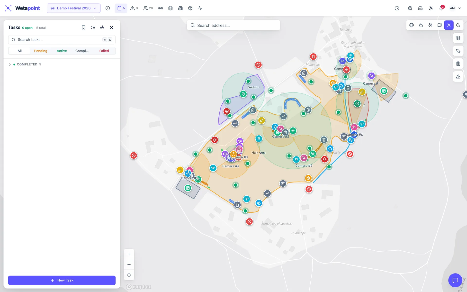
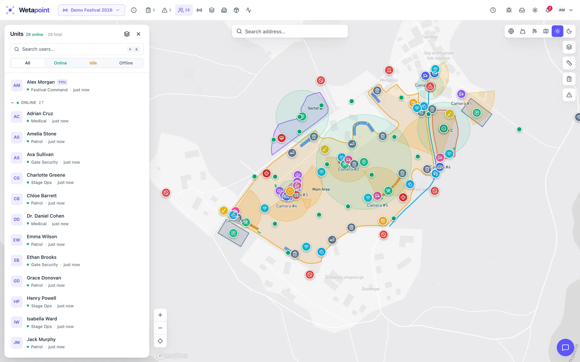
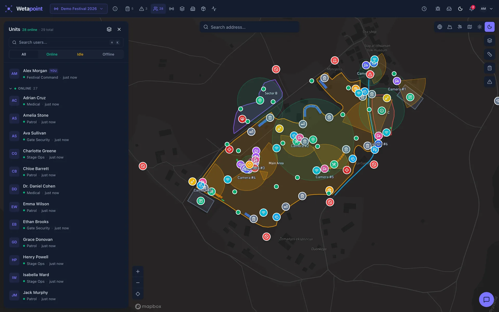
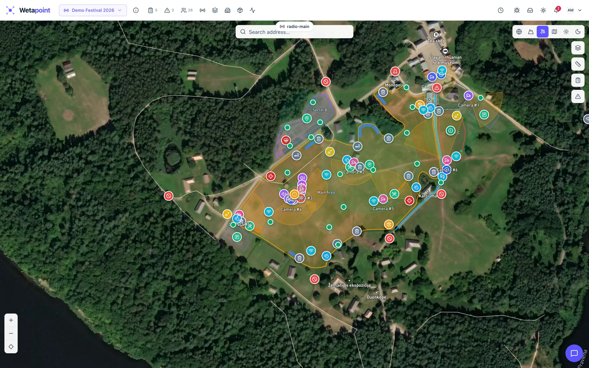
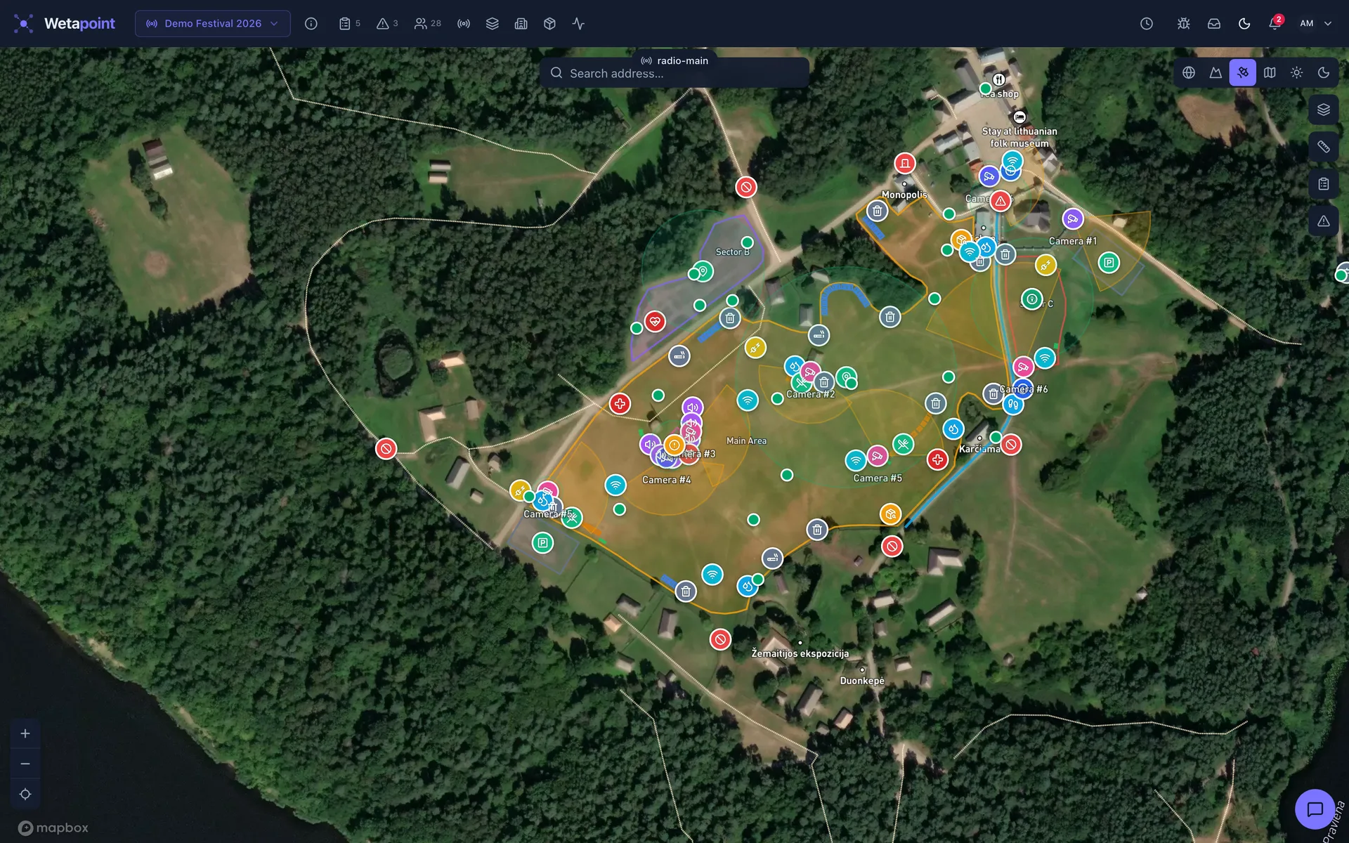
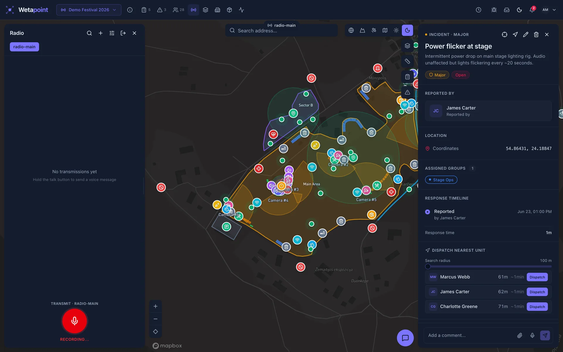
01 — The live map
Command the field from one screen
The actual operations console — captured from a staged demo operation, not a mock-up.
02 — Capabilities
Everything a field operation needs
Six core systems. One data model. One audit trail.
Live GPS tracking
Live positions, full history playback, automatic stale-position detection.
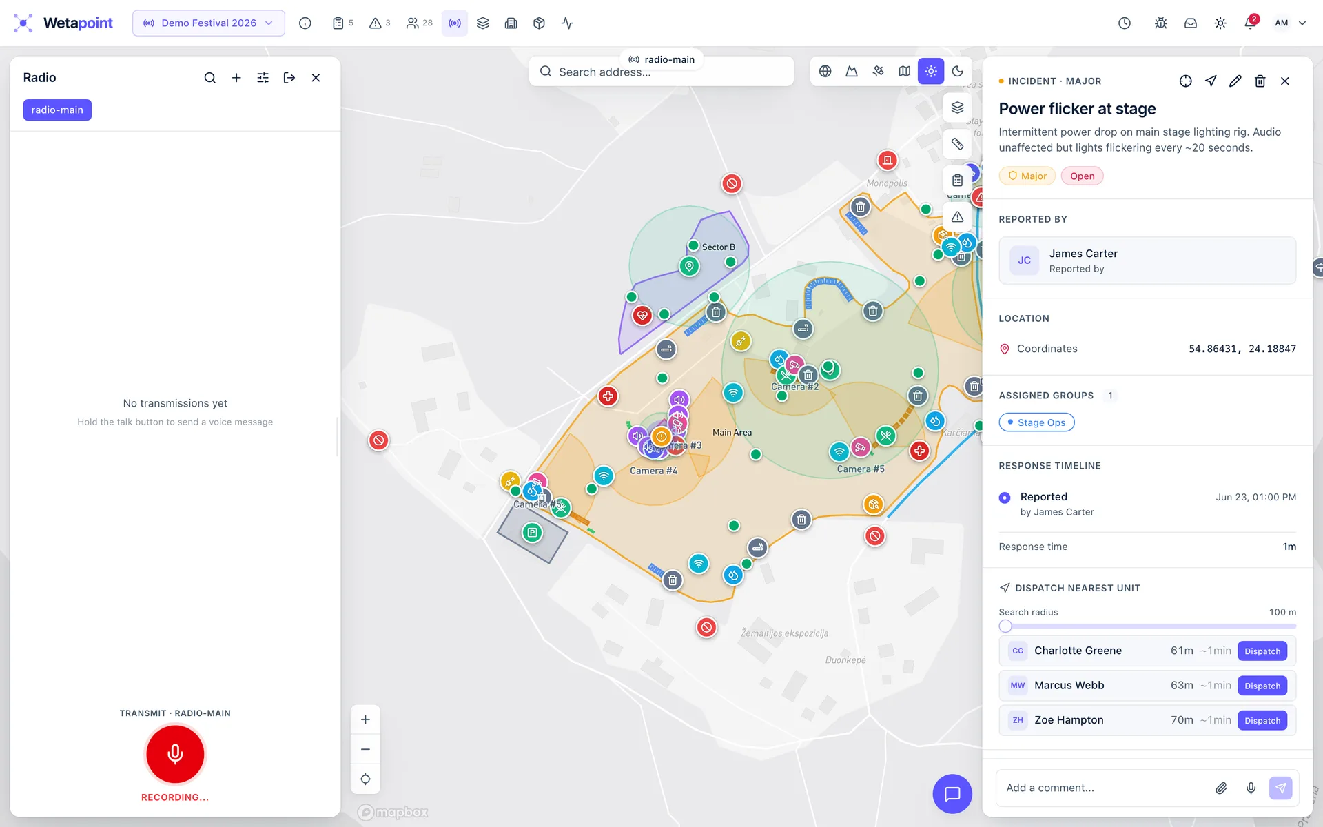
Learn more →Radio, chat & live video
Push-to-talk channels, team messaging, and on-demand phone streams.
Learn more →03 — One platform, four fronts
Different operations. Same backbone.
Festival weekends, forest games, public works, overnight patrols — the dashboards reshape while the data model, integrations, and audit trail stay identical.

Coordinate every team across a 50-hectare venue without losing visibility
A modern festival is a temporary city operating for 72 hours. Coordinating production, security, medical, and volunteer teams across dozens of zones — without overlapping radio chatter, paper rosters, or fragmented chat threads — does not scale. The moment something happens at Stage 4, the wrong people are listening on the wrong frequencies.
- Every staff member, volunteer, and security guard on a single live map — filterable by team, zone, or shift
- Task assignment to individuals or groups, with acknowledgement, status updates, and arrival check-in
- Geofenced zones for stages, medical posts, restricted areas, and back-of-house — set up in under a minute
- Two-way radio with channel-per-team scoping, push-to-talk, and a 30-day voicemail inbox
- Incident logging with timestamped position, photo attachments, and an immutable audit trail
Start free with up to 10 team members. Full feature access included.
Turn any outdoor space into a coordinated multiplayer game
Planning a treasure hunt, geocaching event, or large-scale field game means rebuilding the same coordination layer every time: invitations, checkpoints, team chat, real-time tracking. The off-the-shelf tools assume a desk and a stable connection, not a remote forest with 30 children and rain on the way.
- One-link invitations: participants join the map without account creation or app install
- Checkpoint and finish-line triggers that fire automatically on geographic arrival or dwell
- Path checkpoints with configurable radius and sequence — design any course shape
- Team-scoped chat, zone-scoped chat, and event-wide broadcasts
- Live overview on tablet or phone — every participant visible in real time
Free for groups of up to 10. Upgrade only when you need more.
Bring public works onto one operational map
Municipal field operations still run on three separate systems: vehicle dispatch on radio, citizen reports in a call-centre database, and inspections in spreadsheets emailed between departments. The result is route history reconstructed from memory, citizen reports lost in queues, and inspections nobody can find when an audit lands.
- Live tracking of every vehicle and crew on a single map — plows, sweepers, inspection vans, parks teams, maintenance
- Automatic route logging: the streets a vehicle actually covered, not just the ones it was assigned
- Public report portal: citizens drop pins on potholes, fly-tipping, and broken streetlights from a phone link, no app install required
- Recurring route templates for daily, weekly, and seasonal operations
- REST API and outbound webhooks for integration with existing GIS, asset, and HR systems
Start free for the first crew. Add departments as you roll out.
Patrol management built for evidentiary standards
Paper sign-off sheets, lone-worker check-ins by text message, and camera clips reconstructed days after an incident — that is what most security operations still run on. Insurers, large clients, and regulators are increasingly unwilling to accept that as proof. A patrol either happened or it did not, and the audit trail has to be able to demonstrate which.
- Geofenced patrol routes with timestamped checkpoint visits on an immutable audit timeline
- Path checkpoints with configurable radius and sequence — patrol design is fully editable
- Live video stream from a guard's phone the moment a situation escalates
- Task check-ins that confirm a guard physically reached a zone, not just acknowledged a message
- Immutable audit log: every action recorded with actor, timestamp, and append-only
Run it on a single site for 30 days at no cost.
04 — How it works
Live in an afternoon
Set up your operation
Sign up on the web console, name the operation, and draw your zones, stages, and checkpoints straight onto the map. Minutes, not a rollout project.
Bring your people on
Coordinators and organisers run it from the web console; volunteers, staff, and field crews join on the mobile app from one invite link. A single sign-in and everyone's live on the map.
Coordinate live
Assign tasks on the map, watch GPS check-ins confirm themselves, and run incidents with push-to-talk radio and live video the moment something happens.
05 — Trust & compliance
Built for operations that get audited
Evidentiary logging, GDPR tooling, and least-privilege access are part of the core — not an enterprise add-on.
Role-based access
Five system roles plus custom ones. Field operators see only what their role and team visibility grant — on the map, in tasks, and in chat.
Append-only audit log
Every consequential action is recorded with actor and timestamp, append-only. Nothing is silently edited.
GDPR retention & export
30-day retention, one-click data export, and self-serve erasure.
EU hosting
Data lives in the EU, and the subprocessor list is published and kept current.
06 — Pricing
Transparent pricing that scales with your team
Start free with full feature access for small teams. Upgrade as your operation grows. No setup fees and no surprise charges.
Start free with up to 10 team members — upgrade only when the operation grows.
Free
For small teams, weekend organisers, and pilot deployments.
€0 /month
Get StartedUsers10
Active events1
Live video—
Location history30 days
- Live GPS tracking on a shared map
- Tasks and incident reporting
- Team messaging and channels
- Append-only audit log
- Email support (best-effort)
Starter
For a single team running multiple events per season.
€29 /month
Get StartedUsers25
Active events5
Live video—
Location history30 days
- Everything in Free
- Two-way radio: push-to-talk (iOS & Android), multiple channels
- Geofenced zones with arrival and dwell triggers
- Recurring event templates
- Custom data-collection forms
- GPX track import and playback
- Email support
Team
For growing operations that need radio, video, and integrations.
€89 /month
Get StartedUsers75
Active eventsUnlimited
Live video5 concurrent
Location history90 days
- Everything in Starter
- Live video streaming (up to 5 concurrent)
- PDF reports
- Data exports (CSV, GeoJSON, GPX)
- Analytics dashboard
- Outbound webhooks
- Public share links
- Timeline playback & history
- 90-day location history
Business
For mission-critical operations that need scale and priority support.
€199 /month
Get StartedUsers200
Active eventsUnlimited
Live video20 concurrent
Location history1-year
- Everything in Team
- Live video streaming (up to 20 concurrent)
- 1-year location history
- Priority support
07 — Ready
Put your operation on the map
Free for up to 10 team members with full feature access — and a live demo one click away.